Basics GPS

GPS stands for Global Positioning System and it is a system that can provide a position at any point on the Earth's surface to a very high degree of accuracy. The Global Positioning System (GPS) uses 24 active Navstar satellites in orbit 11 000 miles above the surface of the Earth.

Using economic ground based receivers GPS is able to provide position information to within a number of metres. The economic costs have also meant that it is now fitted to many motor vehicles, while separate GPS receivers can be bought for a few hundred pounds or dollars. As a result it is widely used by private individuals, as well as many commercial and professional users. In fact the primary use for GPS is as a military navigation system. The fact that it is used so widely is a by product of its success.

Basic concept
GPS operates by being able to measure the distances from the satellites that are in orbit around the Earth. By knowing the distance from a number of satellites, it is possible to calculate the position on the Earth's surface and the height above it by a process of triangulation. This a great simplification, but this is essentially how it works.

The satellites all send timing information so the receiver knows when the message was sent. As radio signals travel at the speed of light they take a very short but finite time to travel the distance from the satellite to the receiver. The satellites also transmit information about their positions. In this way the receiver is able to calculate the distance from the satellite to the receiver. To obtain a full fix, four satellites are required, and when the receiver is in the clear, more than four satellites are in view all the time.

Satellites
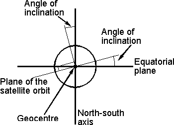
The satellites are orbiting above the Earth. Their orbits are tightly controlled because errors in their orbit will translate to errors in the final positions. The time signals are also tightly controlled. The satellites contain an atomic clock so that the time signals they transmit are very accurate. Even so these clocks will drift slightly and to overcome this, signals from Earth stations are used to correct this.

The satellites themselves have a design life of ten years, but to ensure that there are no holes in service in the case of unexpected failures, spares are held in orbit and these can be brought into service at short notice.

The satellites are provide their own power through their solar panels. These extend to about 17 feet, and provide the 700 watts needed to power the satellite and its batteries when it is in sunlight. Naturally the satellite needs t remain operation when it is on the dark side of the Earth when the solar panels do not provide any power. This means that when in sunlight the solar panels need to provide additional power to charge batteries, beyond just powering the basic satellite circuitry.

Receivers
A large number of GPS receivers are available today. They make widespread use of digital signalling processing techniques. The transmissions from the satellites use spread spectrum technology, and the signal processors correlate the signals received to recover the data. As the signals are very weak it takes some time after the receiver is turned on to gain the first fix. This Time To First Fix (TTFF) may be as long as twelve minutes, although receivers that us a large number of correlators are able to shorten this.

When using a GPS receiver the receiver must be in the open. Buildings, or any structure will mask the signals and it may mean that few satellites can be seen. Thus the receivers will not operate inside buildings, and urban areas may often cause problems.

Applications
The primary use for GPS is as a military navigational aid. Run by the American Department of Defense its primary role is to provide American forces with an accurate means of navigation anywhere on the globe. However its use has been opened up so that commercial and private users have access to the signals and can use the system. Accordingly it is very widely used for many commercial applications from aircraft navigation, ship navigation to surveying, and anywhere where location information is required. For private users very cost effective receivers are available these days and may be used for applications including sailing. Even many motor vehicles have them fitted now to provide SatNav systems enabling them to navigate easily without the need for additional maps.

It can be said that GPS has revolutionised global navigation since it became available. Prior to this navigation systems were comparatively localised, and did not offer anything like the same degrees of accuracy, flexibility and coverage.
Read more....!
Posted by Admin, Tuesday, January 16, 2007 12:12:00 PM | 0 comments |

NAVSTAR Global Positioning System

The Global Positioning System (GPS), is currently the only fully-functional satellite navigation system. More than two dozen GPS satellites are in medium Earth orbit, transmitting signals allowing GPS receivers to determine location, speed and direction.

Since the first experimental satellite was launched in 1978, GPS has become indispensable for navigation around the world, and an important tool for map-making and land surveying. GPS also provides a precise time reference used in many applications including scientific study of earthquakes, and synchronization of telecommunications networks.

Developed by the United States Department of Defense, it is officially named NAVSTAR GPS (Navigation Signal Timing and Ranging Global Positioning System). The satellite constellation is managed by the United States Air Force 50th Space Wing. Although the cost of maintaining the system is approximately US$400 million per year, including the replacement of aging satellites, GPS is free for civilian use as a public good.

A GPS receiver calculates its position by measuring the distance between itself and three or more GPS satellites. Measuring the time delay between transmission and reception of each GPS radio signal gives the distance to each satellite, since the signal travels at a known speed. The signals also carry information about the satellites' location. By determining the position of, and distance to, at least three satellites, the receiver can compute its location using trilateration. Receivers do not have perfectly accurate clocks, and must track one extra satellite to correct their clock error.

Technical description
System segmentation
The current GPS consists of three major segments. These are the space segment (SS), a control segment (CS), and a user segment (US).

Space segment
The space segment is composed of the orbiting GPS satellites, or Space Vehicles (SV) in GPS parlance. The GPS design calls for 24 SVs to be distributed equally among six circular orbital planes. The orbital planes are centered on the Earth, and not rotating with respect to the distant stars. The six planes have approximately 55° inclination (tilt relative to the equator) and are separated by 60° right ascension of the ascending node (angle along the equator).

Orbiting at an altitude of approximately 20,000 kilometers (11,000 nautical miles), each SV makes two complete orbits each sidereal day, so it passes over the same location on Earth once each day. The orbits are arranged so that at least six satellites are always within line of sight from almost anywhere on Earth.

As of January 2007, there are 29 actively broadcasting satellites in the GPS constellation. The additional satellites improve the precision of GPS receiver calculations by providing redundant measurements. With the increased number of satellites, the constellation was changed to a nonuniform arrangement. Such an arrangement was shown to improve reliability and availability of the system, relative to a uniform system, when multiple satellites fail.

The flight paths of the satellites are tracked by monitoring stations in Hawaii, Kwajalein, Ascension Island, Diego Garcia, and Colorado Springs, Colorado, along with monitor stations from other agencies. The tracking information is sent to the Air Force Space Command's master control station at Schriever Air Force Base, Colorado Springs, Colorado, which is operated by the 2d Space Operations Squadron (2 SOPS) of the United States Air Force (USAF). 2 SOPS contacts each GPS satellite regularly with a navigational update (using the ground antennas at Ascension Island, Diego Garcia, Kwajalein, and Colorado Springs). These updates synchronize the atomic clocks on board the satellites to within one microsecond and adjust the ephemeris of each satellite's internal orbital model. The updates are created by a Kalman Filter which uses inputs from the ground monitoring stations, space weather information, and other various inputs.
Read more....!
Posted by Admin, Thursday, January 11, 2007 10:45:00 AM | 0 comments |

System Satellite Orbits

The variety of different orbits that can be adopted for satellites. The ones that receive the most attention are the geostationary orbit used by many communications and direct broadcast satellites for satellite television and also the low earth orbit ones that travel around the global. Those used in the Navstar or Global Positioning (GPS) system occupy a relatively low earth orbit. There are also many other types of satellite from weather satellites to research satellites and many others.

The actual orbit that is chosen will depend on factors including its function, and the area it is to serve. In some instances the orbit may be as low as 100 miles (160 km) for a low earth orbit (LEO), whereas others may be over 22 000 miles (36000 km) high as in the case of a geostationary orbit. The satellite may even have an elliptical rather than a circular orbit.

Gravity
As satellites orbit the earth they are pulled back in by the force of the gravitational field. If they did not have any motion of their own they would fall back to earth, burning up in the upper reaches of the atmosphere. Instead the motion of the satellite rotating around the earth has a force associated with it pushing it away from the earth. For any given orbit there is a speed for which gravity and the centrifugal force balance each other and the satellite remains in a stable orbit, neither gaining height nor loosing it.

Obviously the lower the orbit, the stronger the gravitational pull, and this means that the satellite must orbit the earth faster to counteract this pull. Further away the gravitational field is less and the satellite velocities are correspondingly less. For a very low orbit of around 100 miles a velocity of about 17500 miles per hour is needed and this means that the satellite will orbit the earth in about 90 minutes. At an altitude of 22 000 miles a velocity of just less than 7000 miles per hour is needed giving an orbit time of about 24 hours.

Circular and elliptical orbits
A satellite can orbit the earth in one of two basic types of orbit. The most obvious is a circular orbit where the distance from the earth remains the same at all times. A second type of satellite orbit is an elliptical one.


When a satellite orbits the earth, either in a circular or elliptical orbit, the satellite orbit forms a plane that passes through the centre of gravity or geocentre of the Earth. The rotation around the earth is also categorised. It may be in the same direction as the earth's rotation when it is said to be posigrade, or it may be in the opposite direction when it is retrograde.

The track of the satellite around the globe is often defined as well. The point on the Earth's surface where the satellite is directly overhead moves around the globe. This is known as the ground track. This forms a circle which has the geocentre at its centre. It is worth noting that geostationary satellites are a special case as they appear directly over the same point of the earth all the time. This means that their ground track consists of a single point on the earth's equator. Also for satellites with equatorial orbits the ground track is along the equator.

Satellites may also be in other orbits. These will cross the equator twice, once in a northerly direction, and once in a southerly direction. The point at which the groundtrack crosses the equator is known as a node. There are two, and the one where the groundtrack passes from the southern hemisphere to the northern hemisphere is called the ascending node. The one where the groundtrack passes from the northern to the southern hemisphere is called the descending node. For these orbits it is usually found that the groundtrack shifts towards the west for each orbit because the earth is rotating towards the east underneath the satellite.

For many orbit calculations it is necessary to consider the height of the satellite above the geocentre. This is the height above the earth plus the radius of the earth. This is generally taken to be 3960 miles or 6370 km.

Velocity is another important factor as already seen. For a circular orbit it is always the same. However in the case of an elliptical one this is not the case as the speed changes dependent upon the position in the orbit. It reaches a maximum when it is closest to the earth and it has to combat the greatest gravitational pull, and it is at its lowest speed when it is furthest away.

Elliptical orbits are often used, particularly for satellites that only need to cover a portion of the Earth's surface. For any ellipse, there are two focal points, and one of these is the geocentre of the Earth. Another feature of an elliptical orbit is that there are two other major points. One is where the satellite is furthest from the Earth. This point is known as the apogee. The point where it is closest to the Earth is known as the perigee.

The plane of a satellite orbit is also important. Some may orbit around the equator, whereas others may have different orbits. The angle of inclination of a satellite orbit is shown in Figure 8.2. It is the angle between a line perpendicular to the plane of the orbit and a line passing through the poles. This means that an orbit directly above the equator will have an inclination of 0 degrees (or 180 degrees), and one passing over the poles will have an angle of 90 degrees. Those orbits above the equator are generally called equatorial obits, whilst those above the poles are called polar orbits.


A further feature of any satellite is the angle of elevation above the Earth's surface at a given position on the Earth and a given time. It is very important because the earth station will only be able to maintain contact with the satellite when it is visible. The angle of elevation is the angle at which the satellite appears above the horizontal. If the angle is too small then signals may be obstructed by nearby objects if the antenna is not very high. For those antennas that have an unobstructed view there are still problems with small angles of elevation. The reason is that signals have to travel through more of the earth's atmosphere and are subjected to higher levels of attenuation as a result. An angle of five degrees is generally accepted as the minimum angle for satisfactory operation.

In order that a satellite can be used for communications purposes the ground station must be able to follow it in order to receive its signal, and transmit back to it. Communications will naturally only be possible when it is visible, and dependent upon the orbit it may only be visible for a short period of time. To ensure that communication is possible for the maximum amount of time there are a number of options that can be employed. The first is to use an elliptical orbit where the apogee is above the planned earth station so that the satellite remains visible for the maximum amount of time. Another option is to launch a number of satellites with the same orbit so that when one disappears from view, and communications are lost, another one appears. Generally three satellites are required to maintain almost uninterrupted communication. However the handover from one satellite to the next introduces additional complexity into the system, as well as having a requirement for at least three satellites.

Circular orbits
Circular orbits are classified in a number of ways. Terms such as Low Earth orbit, Geostationary orbit and the like detail distinctive elements of the orbit:

* Low Earth Orbit (LEO: 200 - 1200km above the Earth's surface)
* Medium Earth Orbit (MEO or ICO: 1200 - 35790 km)
* Geosynchronous Orbit (GEO: 35790 km above Earth's surface)
* Geostationary Orbit (GSO)
* High Earth Orbit (HEO: above 35790 km)

The LEO and MEO are used for many types of satellite. As they are relatively close to the Earth's surface they orbit in times much shorter than those higher up. This is because there is a particular velocity required at any given altitude for the gravitational and centrifugal forces to balance. Also the path loss to and from the satellite is much lower in view of the shorter radio paths involved.

As the height of a satellite increases, so the time for the satellite to orbit increases. At a height of 35790 km, it takes 24 hours for the satellite to orbit. This type of orbit is known as a geosynchronous orbit, i.e. it is synchronized with the Earth.

One particular form of geosynchronous orbit is known as a geostationary orbit. In this type of orbit the satellite rotates in the same direction as the rotation of the earth and has a 24 hour period. This means that it revolves at the same angular velocity as the earth and in the same direction and therefore remains in the same position relative to the earth. Geostationary orbits are very popular because once the earth station is set onto the satellite it can remain in the same position, and no tracking is normally necessary. This considerably simplifies the design and construction of the antenna. For direct broadcast satellites it means that people with dishes outside the home do not need to adjust them once they have been directed towards the satellite.

Once in a geostationary orbit, the satellite needs to be kept in its position and not drift. Small rockets are installed on a satellite to ensure that any deviations can be corrected.

The path length to any geostationary satellite is a minimum of 22300 miles. This gives a small but significant delay of 0.24 seconds. For a communications satellite this must be doubled to account for the uplink and downlink times giving virtually half a second. This delay can make telephone conversations rather difficult when satellite links are used. It can also be seen when news reporters as using satellite links. When asked a question from the broadcasters studio, the reporter appears to take some time to answer. This delay is the reason why may long distance links use cables rather than satellites as the delays incurred are far less.

In some applications high earth orbits may be required. For these applications the satellite will take longer than 24 hours to orbit the Earth, and path lengths may become very long resulting in additional delays for the round trip from the Earth toth e satellite and back as well as increasing the levels of path loss.
The choice of the satellite orbit will depend on its applications. While geostationary orbits are popular for applications such as direct broadcasting and for communications satellites, others such as GPS and even those satellites used for mobile phones are much lower.
Read more....!
Posted by Admin, Saturday, January 06, 2007 9:54:00 AM | 0 comments |

Applications of Satellite

There are many applications for satellites in today's world. Ever since the first satellite, Sputnik 1, was launched in 1957, large numbers of satellites have been launched into space to meet a variety of needs. As satellite technology has developed over the years, so ahs the number of applications to which they can be put. Whatever the type of satellite it is necessary to be able to communicate with them, and in view of the large distances, the only feasible technology is radio. As such radio communication is an integral part of any satellite system, whatever its application.

Satellite applications

Astronomical satellites - these satellites are used for the observation of distant stars and other objects in space. Placing an observation point in space removes the unwanted effects of the atmosphere and enables far greater levels of detail to be seen than would be possible on earth where many observatories are placed on mountain tops that experience low levels of cloud. The most famous astronomical satellite is the Hubble Telescope. Although now reaching the end of its life it has enabled scientists to see many things that would otherwise not have been possible. Nevertheless it did suffer some major design setbacks that were only discovered once it was in orbit.

Communications satellites - these satellites possible form the greatest number of satellites that are in orbit. They are used for communicating over large distances. The height of the satellite above the Earth enables the satellites to communicate over vast distances, and thereby overcoming the curvature of the Earth's surface.
Even within the communications field there are a number of sub-categories. Some satellites are used for point to point telecommunications links, others are used for mobile communications, and there are those used for direct broadcast. There are even some satellites used for mobile phone style communications. Even though these satellites did not take the market in the way that was originally expected because terrestrial mobile phone networks spread faster than was originally envisaged, some mobile phone satellite systems still exist.

Earth observation satellites - these satellites are used for observing the earth's surface and as a result they are often termed geographical satellites. Using these satellites it is possible to see many features that are not obvious from the earth's surface, or even at the altitudes at which aircraft fly. Using these earth observation satellites many geographical features have become obvious and they have even been used in mineral search and exploitation.

Navigation satellites - in recent years satellites have been used for accurate navigation. The first system known as GPS (Global Positioning System) was set up by the US DoD and was primarily intended for use as a highly accurate military system. Since then it has been adopted by a huge number of commercial and private users. Small GPS systems are available at costs that are affordable by the individual and are used for car navigation, and they are even being incorporated into phones in a system known as A-GPS (Assisted GPS) to enable accurate location of the phone in case of emergency.
Further systems are planned for the future. The Russian system known as Glonass and the European and Chinese system Galileo are planned for the future.

Reconnaissance satellites - these satellites, are able to see objects on the ground and are accordingly used for military purposes. As such their performance and operation is kept secret and not publicized.

Weather satellites - as the name implies these satellites are used to monitor the weather. They have helped considerably in the forecasting of the weather and have helped provide a much better understanding not only of the underlying phenomena, but also in enabling predictions to be made. A variety of these satellites are in use and include the NOAA series.


There are now many thousands of satellites in orbit around the Earth. Many are in operations, while some that have not yet fallen out of orbit are still circling the Earth. The operational satellites provide many of the services on which we rely today. Without them many of the services which we have come to accept as normal would not be so nearly to achieve by other means.
Read more....!
Posted by Admin, Tuesday, January 02, 2007 3:43:00 PM | 0 comments |

Satellite facts and information

Facts about numbers of satellites in orbit
There are over 2500 satellites in orbit around the Earth
There are also over 10 000 man made objects orbiting around the Earth. These include a variety of pieces of satellite debris ranging from panels to disused equipment.

Facts about satellite firsts
The first satellite named Sputnik 1 was launched by the Soviet Union on 4th October 1957. It was a football sized globe that transmitted a "beep beep" sound as it orbited the Earth. The word Sputnik means satellite. It continued transmitting for about 21 days. It was followed four months later by the US satellite Explorer 1 which was launched on 31st January 1958.

Possibly one of the best known satellites was Telstar 1. Built by AT&T it was launched on July 10, 1962, and on the same day live television pictures originating in the United States were received in France.

Facts about satellite orbits
Most communications satellites use what is termed a geostationary orbit. These are at an altitude of, around 22,000 miles and as a result of their speed and the circumference of the orbit they travel round the Earth above the equator in 24 hours. As they travel at the same rate that the Earth rotates, they stay above the same point on the Earth's surface all the time.

In contrast, Low Earth Orbits are just above the Earth's atmosphere and are typically between 100 and 800 miles in altitude. Orbiting at this altitude, an object may only take about 90 minutes to completely circle the Earth, travelling at around 17,000 miles per hour. Low Earth Orbit is used by manned vehicles such as the space shuttle and the International Space Station. It is also used for weather and remote sensing satellites. On a clear night it is usually possible to see with the naked eye several satellites in low earth orbit passing overhear.

Facts about the Global Positioning System (GPS)
The GPS system is run by the US Department of Defense. It consists of 24 operational satellites although there are some extra in orbit as spares in case of catastrophic failure even though each satellite is built to last for ten years. The satellites are named Navstar satellites and each one weighs around 1860 pounds. They are about 17 feet across with the solar panels extended, and they transmit about 50 watts, although the solar panels generate around 700 watts.

The satellites are in one of six orbits. These are in planes that are inclined at approximately 55 degrees to the equatorial plane and there are four satellites in each orbit. The orbits that are roughly 20200 km above the surface of the earth and the satellites travel at a speed of around 14000 km / hour (i.e. about 8500 mph) which means they complete each orbit in roughly 12 hours.
Read more....!
Posted by Admin, 3:33:00 PM | 0 comments |

Your Ad Here